Visual Information Technology in Surveying and Engineering Industries – Part 3

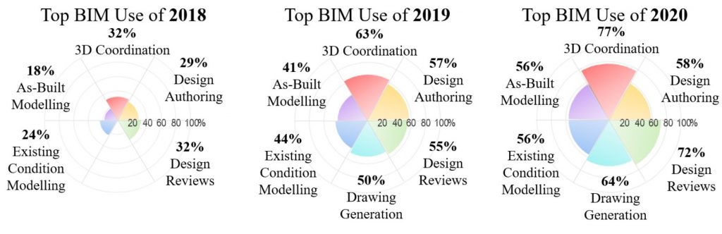
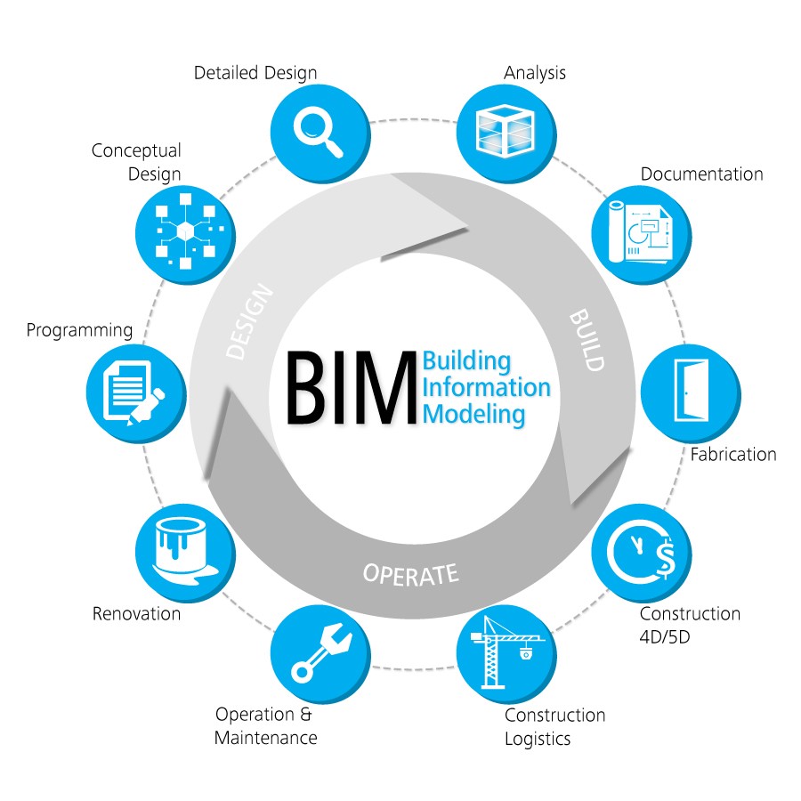
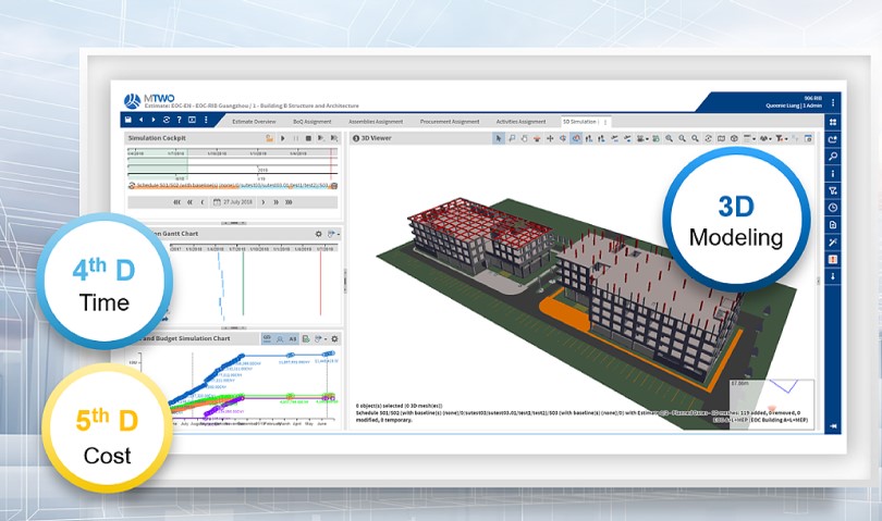
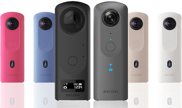
Last year we have talked about how 360 camera can help in surveying and engineering industry. By using the 360 cameras which can help us to inspect some of the unreachable areas. However, there are still a lot of areas need to inspect and record. Today we are going to talk about the other camera or measuring tools can help in our daily operation. In the past, surveyors or engineer worked with the existing buildings with a camera and record plan for all documentation and report to our clients. With the aid of technology, surveyors and engineers can work with 3D environment for recording. According to RICS, it states that the tendency to believe that BIM is the sole preserve of new-build construction overlooks the advantages it can have for the management and refurbishment of existing buildings. The recent latest technology have been capturing the As-built conditions in 3D or Scan-to-BIM using Point Cloud.

Scan to BIm

Refer to Trimble, 3D laser scanning allows contractors to collect the as-is conditions on a project site quickly to provide both accurate and up-to-date data that is valuable throughout the different design and construction stages. It is then used to verify as-built models, monitor progress on a project, create as-built models for existing structures or to augment missing design data. Many projects now require a contractor to deliver a point cloud as a final project deliverable to document the location of new construction for the building owner.

Scan to BIM allows you to create a highly accurate three-dimensional digital representation of your building – in a reduced amount of time.

Some of the advantages of Scan to BIM:

  • It removes a large degree of human error from traditional as-built documentation processes
  • The data is collected over a considerably shorter period of time
  • Information can be shared faster
  • Teams only need to visit the site once to collect data

Source:

https://constructible.trimble.com/construction-industry/what-is-scan-to-bim-2

However, the laser scanning can be very expensive. The service contractor may need to take time for scheduling as they need to reserve the laser scanning machine to provide the service. However, most of the project stakeholders only require for rough measurement of building features. Photogrammetry will be the best choice in this case.

Photogrammetry


Photogrammetry is the art, science, and technology of obtaining reliable information about physical objects and the environment through processes of recording, measuring, and interpreting photographic images and patterns of recorded radiant electromagnetic energy and other phenomena (Wolf and Dewitt, 2000; McGlone, 2004).

Source: https://bit.ly/35toRIq

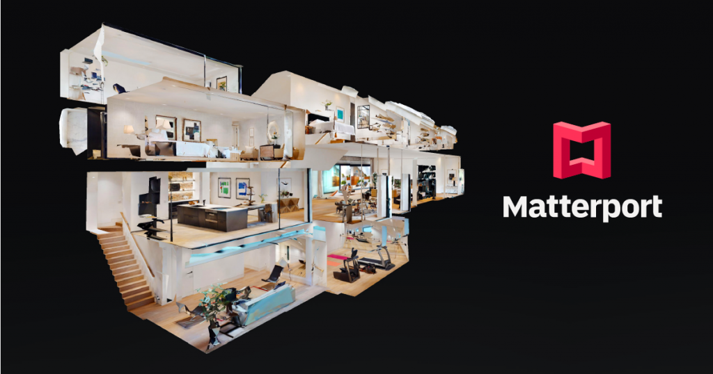
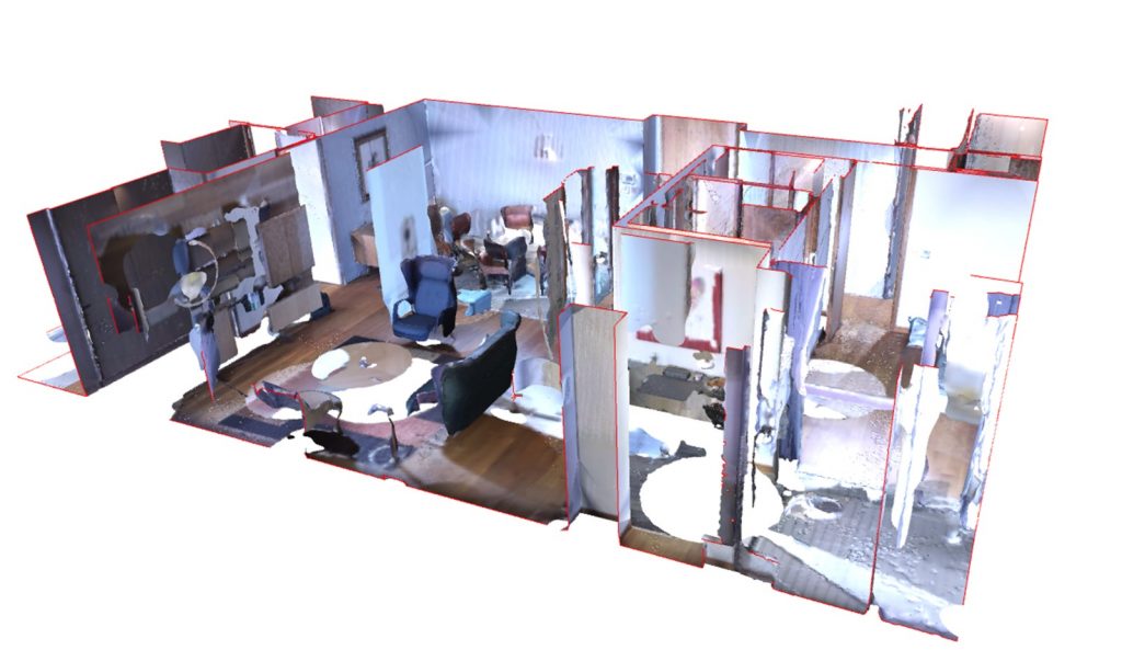
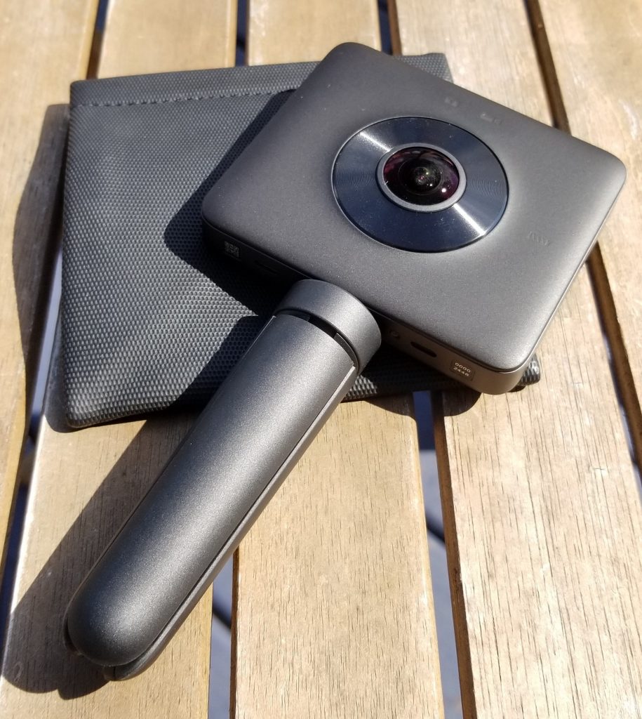
Matterport is a good start of photogrammetry which our client can use the web based program for 24/7 review the existing conditions of the building. Matterport is the standard for 3D space capture. Our all-in-one platform transforms real-life spaces into immersive digital twin models. So much more than panoramic scans, Matterport empowers people to capture and connect rooms to create truly interactive 3D models of spaces. GBE has the Matterport Pro 2 camera which can capture the matterport solution. Pro2 3D Camera can work out with high-quality 3D capture with unlimited 4K print quality photography. Professional photo resolution (134 megapixels) and 3D accuracy. Great at scanning any size space. Perfect for homes, apartments, hotels, commercial buildings. You may refer one of our matter port solution for Hing Wai building for reference.

https://my.matterport.com/show/?m=L9uodzruqeQ

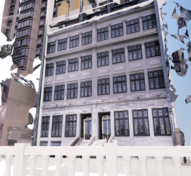
However, there still some limitation with the matterport. Matterport works great for interior in the building. However, for exterior like facade or the area which it not possible to put the tripod. Therefore, we will change to use drones and cameras for our mesh model. As PhotoModeler states that Photogrammetry is an appealing choice for BIM because it offers most of the strengths of laser scanning, with few of the downsides. Photogrammetry is the science of taking measurements from photographs. Essentially, it allows construction teams to take digital photos of a site or building, upload it onto a computer, and generate a 3D model.

Laser Scanning


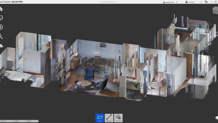
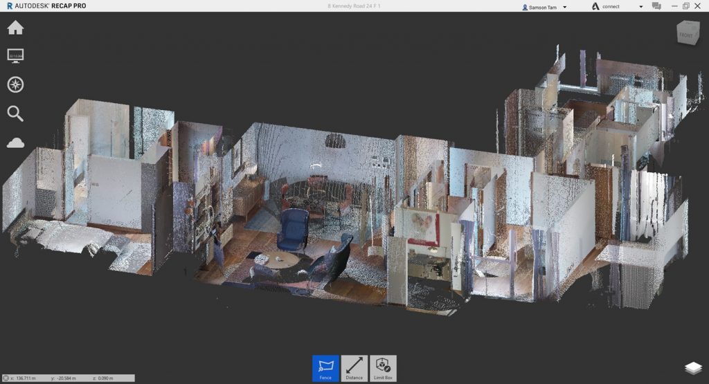
Laser scanning can more more accurate measurement in a range of millimeters error. According to Donato Pica and Fonbeyin Henry Abanda, a laser scanner is a technology based on the use of specific laser light and image sensors, opportunely assembled on a moving structure generally positioned on a tripod support structure, that is directly posed on the ground. Laser scanners can be used for the identification levels and measurement of distances. Laser scanners can be used to measure the distance between a landmark and an assigned point belonging to the surrounding environment, fundamentally evaluating the time elapsed between two pulses or evaluating the phase difference between the emitted and the received wave. By automatically and consequentially repeating this operation for a considerable number of different points, the laser scanner can generate a point cloud.

Source: https://bit.ly/3tTJwP4

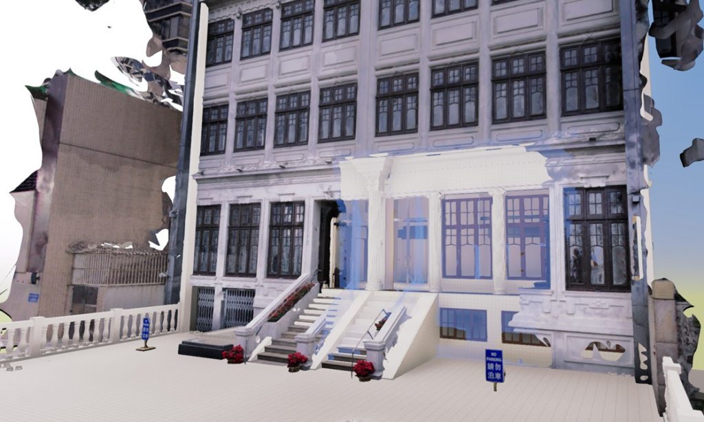
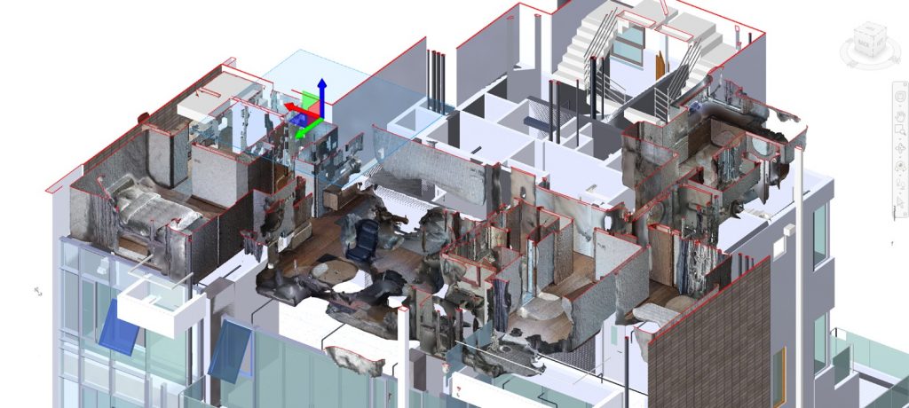
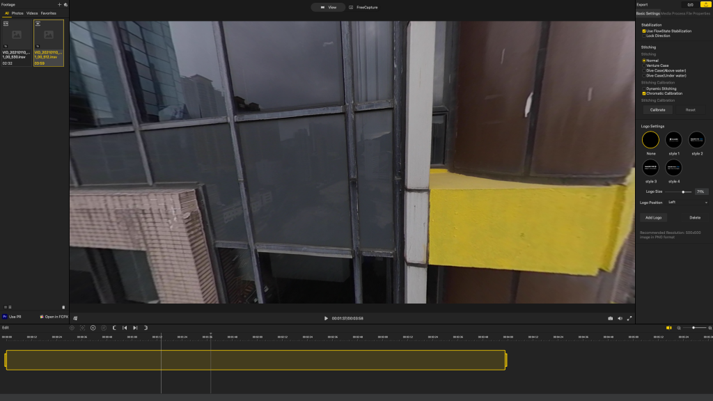
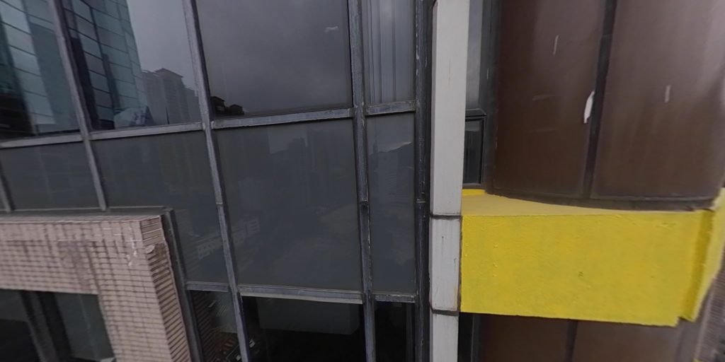
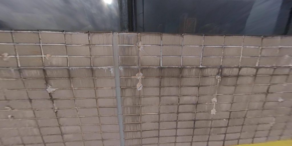
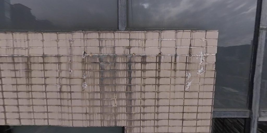
GBE has equipped a Leica BLK360 laser scanner which can create an accurate point cloud model for inspection and also with all building features measurement. Here is some of the examples that we have use the point cloud model compare with our BIM model for verification.

Building Information Modelling (BIM)

BIM is not new to the architecture, engineering and construction industry, it is a process that takes advantage of design technology to create better, faster, and more cost-effective outcomes. From 2018 to 2020, the adoption rate have surged by over 30% in Hong Kong, so it is the time for us to learn what is BIM and why so many companies adopt BIM.

BIM in Hong Kong: https://www.bim.cic.hk/Upload/publication/87/download_2/b55a28ce365e436292cf0e5de923b09e.pdf

BIM in construction: http://www.convertbim.com/succeed-implementing-bim-process-part-2/

What is BIM?

BIM is not software, but a process. Software is the technological core of BIM, which supports 3D design, intelligent models and information management, but it only represent part of BIM. Another part is social components, including the work practice that utilize software collaboration and coordination. Therefore, BIM represent the process to construct a digital information model for a building.

Common Software for BIM: https://veracityconsultant.com.tw/what-is-bim

BIM is so much more than a design tool, within a BIM process, a project team contribute information and data about a proposed building in a shared digital space. The digital information contributed could include specifications, schedules, performance, requirements, programmes, cost plans, and so on, and of course some drawings. Those drawings are created in 3D, while the non-graphical information is linked to the graphical 3D models, when you explore and click on different parts of the 3D representation, you’ll be able to access the information about it. Clicking on a light for example might give you information on its manufacturer, cost, performance level and when it will need replacing. Hence, BIM is not only for architects, but for all parties that involves in construction.

How to contribute information to BIM: https://www.a2kstore.com/understanding-levels-of-bim

Information linked in BIM: https://www.thenbs.com/knowledge/what-is-building-information-modelling-bim

Why Use BIM?

Executive Director Building Information Management at National Institute of Building Science suggest that BIM cut construction cost by 13% to 20%. A study from the Stanford University Centre for Integrated Facilities Engineering suggested that BIM attribute a 7% reduction in time for project completion.

Construction cost reduce 20%

Construction time reduce 7%


In the traditional way of construction, project information is not used efficiently, much information is wasted due to mistrust, do not know what information is available, lack of process and standards as well as information not yet complete. According to the research from U.S. Department of Commerce Technology Administration, in traditional method of construction, the poor use of data coupled with highly fragmented teams cost the US capital facilities industry $15.8 billion annually, 2/3 of which is paid for by the owners. While BIM have clear guideline for information management, it clarifies how to create and share data by stating the requirement for who, when and how they provide data as well as the quality check to be undertaken to ensure accurate data. BIM Adoption Survey 2019 conducted by HK CIC found that near 90% of BIM Leaders in Hong Kong agree BIM enhance communication.

Huge cost for information misuse: https://damassets.autodesk.net/content/dam/autodesk/www/solutions/bim/BIM_for_Owners.pdf

BIM enhance communication

Worse still, 30% of the construction cost in U.S. is paid for rework, for example, the air conditioning duct is designed to go through a load-bearing walls. But since this arrangement only appears in the air conditioning plan, construction workers do not realize it until the load-bearing walls has already been built, they can only change the design in the construction site. From the MacLeamy curve, we understand that the project becomes more costly to change when it is in later stages. A study from the Stanford University Centre for Integrated Facilities Engineering reports that the function of clash detections in BIM resulting in savings of as much as 10% of the contract value.

MacLeamy curve: https://www.cibsejournal.com/cpd/modules/2016-12-bim/

Reduce Rework

Based on the research from U.S. Department of Commerce Technology Administration, in traditional way of construction, more than 60% of the capital invested failed to meet schedule target. For example, in traditional method, cost estimating requires Quantity Surveyors to count components one by one, while BIM software can count itself. A study from the Stanford University Centre for Integrated Facilities Engineering suggested that BIM decrease 80% in the time required to generate an expenditure quote. BIM Adoption Survey 2019 conducted by HK CIC found that over 80% of BIM leader agree BIM enhance time management.

Time and Cost Estimation in BIM: https://clouda2k.co.uk/entering-the-5th-dimension-3d-bim-to-5d-bim/

BIM enhance time management

GBE welcomes comments from professionals and enquiries from the Public.

Visual Information Technology in Surveying and Engineering Industries – Part 2

The coronavirus pandemic has affected most of the people around the world. After one year of affection, people started to change their work habits and business model in order to suit this unexpected situation. Work from home(WFH) become the most common arrangement for millions, increasing numbers of people had been saying goodbye to their office. Thanks to communication technologies like skype, Facetime, Slack, Zoom, Google Hangouts and etc; people can still connect and communicate with each other. However, for surveying and engineering industry, inspection or measurement are still necessary work on site. Today we are going to look through how technology may help our architects, engineers, surveyors and all stakeholders to inspect and work throughout the visual information.

Brief History of 360 Panorama

Virtual reality, aerial panorama and 360 panorama are great technologies to use for providing information to all stakeholders. In 1826, Joseph Nicéphore Nièpce invented photography; he took the first photo in the world for more realistic visual information.


Credit: https://www.bygonely.com/bg_item/photography-1793-by-joseph-nicephore-niepce/

After the photography was invented, the first panoramic photo camera has invented since 1843. Here is the vintage panoramic photo taken by George Barnard in 1864 which can show clearly and more information throughout the photo.


Credit: https://www.loc.gov/resource/pan.6a00039

Evolution of Action Camera

Thanks for the technology so far, action camera can take panoramic photo in one single shot. The first GoPro camera was launched commercially in 2004.


Credit: https://media.techeblog.com/images/first-gopro-camera.jpg

With GoPro evolution, action camera is a suitable camera in all extreme condition which is the best tool for inspection. However, for either filmmaking or inspection; more visual information which help the editors or inspectors easier to get the information. Therefore, people use the action camera for 360 films or 360 photos


Evolution of GoPro Action Camera

Credit: https://cheesycam.com/first-problems-with-gopro-hero4-4k-camera-dangerous-battery/gopro-evolution-original-hero-hero2-hero3-hero3-plus-hero4-4k/

GoPro Omni 360

Credit: https://vrscout.com/news/gopro-360-omni-camera-rig-on-sale/


From Action Camera to 360 Camera

As the spherical 360 panoramas taken from the GoPro device above still need to use the software to align and edit. It is such a time consuming work flow and not easy for normal people. Luckily, Ricoh has latched their first 360 camera which is the world’s first commercially available spherical camera. This camera become the best tool for inspection which is easy to use and edit in order to get the information.


Credit: https://theta360.com/en/

Ricoh Theta Sample Photo


GBE used both Mi sphere and Insta 360 One X as our inspection tools for visual inspection which the 360 camera helps all stakeholder easy to review the footage and capture the information throughout the image. Here is our first YouTube clip for using 360 camera in our inspection project which give a brief idea of how 360 camera can provide information.

MI Sphere Camera

Credit: https://qwertyarticles.com/2018/06/30/the-world-seen-from-360-degrees-a-mi-sphere-camera-review/


Insta 360 One X

Credit: https://www.insta360.com/hk/product/insta360-onex

Visual Information from 360 Camera

By using the software provided by 360 camera manufacturer, the stakeholder can easily capture and collect information from the footage which can easily work remotely and share information to collaborate with others in every project. Here are the sample of the GBE project for you guys to have some idea how the picture can be capture through the software.


Here are other sample photos captured from Insta 360 One X


In next chapter, we will go through the 3D virtual space by using the latest technology and 360 camera in our industry for visual information.